The Law of the River: Developing the Upper Basin
This is the second in a series of blog posts that will explore records held by the Utah State Archives that help illuminate the story of Utah’s role in the larger western movement to tame and develop the Colorado River as a vital resource in the arid west.
UPPER COLORADO RIVER BASIN COMPACT
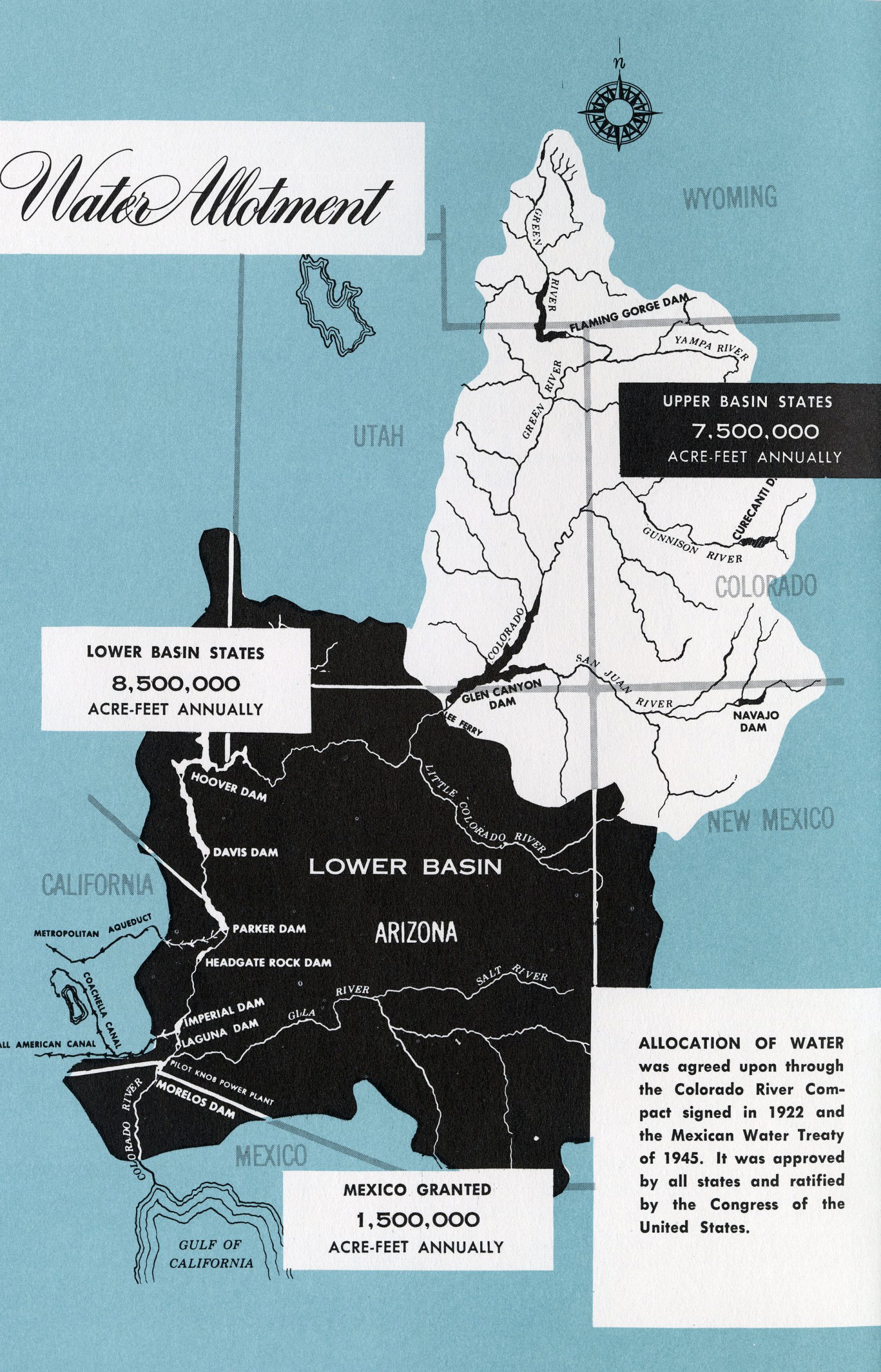
With the passage of the Colorado River Compact of 1922, the Colorado River Basin was divided into a Lower Basin unit (comprised of Arizona, California, and Nevada), and an Upper Basin unit (composed of Colorado, New Mexico, Utah, and Wyoming). For the first twenty-five years after the compact was ratified, the bulk of development that took place on the river occurred in the Lower Basin. The construction of Hoover Dam, and other projects in the Lower Basin, had a direct impact on growing the human populations of the southwest. This, in turn, fueled the need for ever-more water in the region.
With the lower basin’s voracious hunger for water, a movement to begin developing the Upper Basin’s water allotment gained real momentum. This movement was fueled, in part, by concerns among leaders in the Upper Basin that unclaimed water in the north could be forever captured and taken by the unquenchable thirst of agriculture and populations sprouting up in California, Arizona, and southern Nevada.
Negotiations for how to divide the Upper Basin share of the river began when representatives from each Upper Basin state met to discuss the issue in 1946. Utah’s interests in this ongoing negotiation were represented by both Governor Henry Hooper Blood, as well as Utah State Engineer, Ed H. Watson. Records from Watson’s office, in particular, reveal how prominently involved the State Engineer was in ensuring Utah received an equitable portion of the Upper Basin river allotment.
Two years of negotiation and planning ultimately culminated in the Upper Colorado River Basin Compact of 1948. This new accord added another chapter to the expanding Law of the River by guaranteeing a fixed percentage of water from the Colorado River to each Upper Basin state on an ongoing annual basis. Under the terms of this agreement, Colorado would 52% of the Upper Basin share, Utah 23%, Wyoming 14%, and New Mexico 11%. In addition, Arizona wasr allotted a 50,000 acre foot share for the small portion of the state that lies north of the division boundary line at Lee’s Ferry.
With agreement between the Upper Basin states on how to share their allotment of the Colorado River, the stage was set for the emergence of a massive, federally backed plan that would usher in an era of unprecedented change in the Intermountain West.
THE COLORADO RIVER STORAGE PROJECT ACT
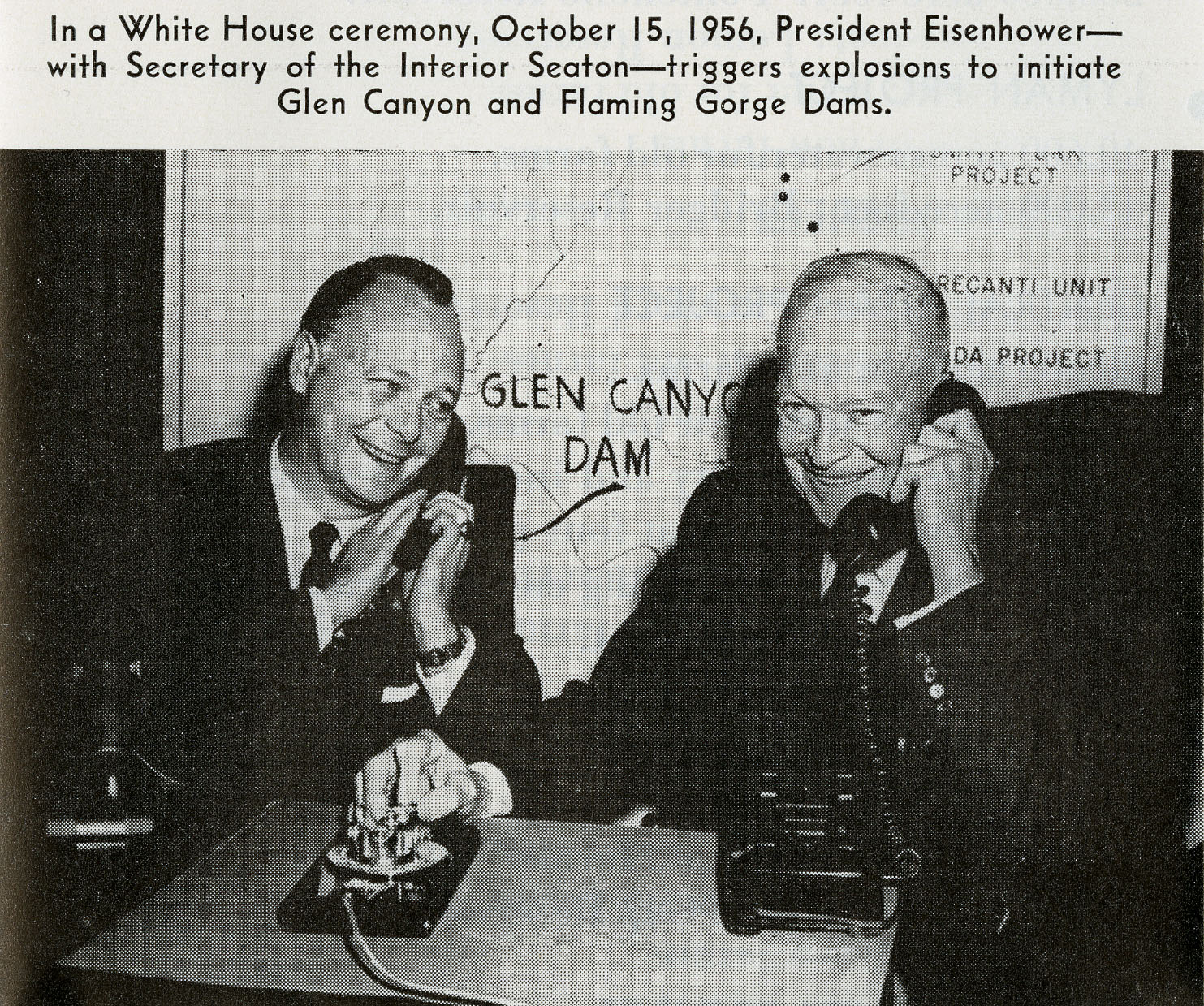
With a compact among the Upper Basin states in place, a plan begin to take shape that would coordinate and guide development in Colorado, New Mexico, Utah, and Wyoming. Over the course of eight years, planning and negotiations took place that finally culminated with passage of the Colorado River Storage Project Act (CRSPA) of 1956.
The provisions of this plan were broad and complex. At its heart the CRSPA sought to set in motion the construction of major water storage projects in the Upper Basin, as well as devise the means for transporting water across vast areas for the benefit of municipalities in the Colorado River Basin. CRSPA also marked a moment of important transition for the Bureau of Reclamation, and how it approached dam construction in the arid west. Prior development in the Lower Basin was done for the primary purpose of impounding a water supply that could be used for irrigation. Hoover Dam allowed for the generation of electrical power, but power generated by the dam was sold to growing populations in Los Angeles and Las Vegas, with the cash generated from that sale being used to pay off the original construction costs for the dam.
With CRSPA, a new model employed by the Bureau of Reclamation in its dam construction and management. Under this new method, the preeminent use of impounded water in the Upper Basin was no longer for irrigation, but rather for hydroelectric power generation that could be sold cheaply to the public. Revenues generated by these “cash register” dams were then used to subsidize farmers in the Upper Basin who, due to environmental constraints inherent to the Intermountain West, were generally unable to grow the wide variety of agricultural commodities routinely produced by their counterparts in the Lower Basin. This thorny issue of balancing a public utility produced by a government agency against the interests of private public utility companies became one of extreme importance to the administration of Utah Governor George D. Clyde in the early 1960’s.
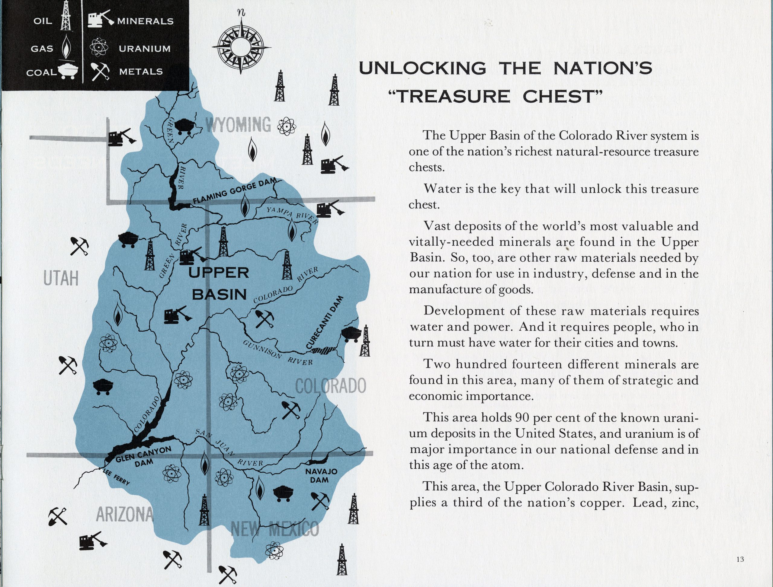
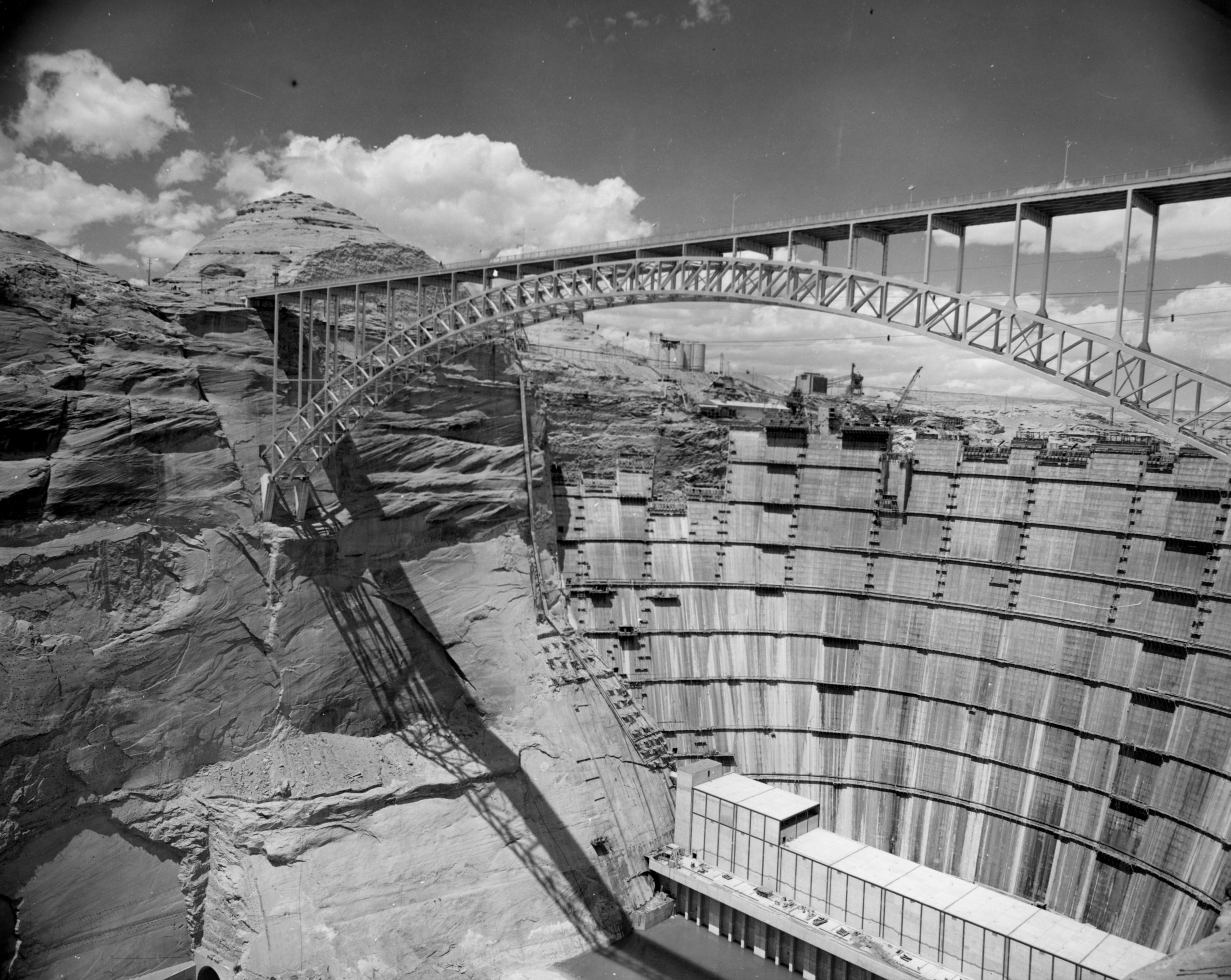
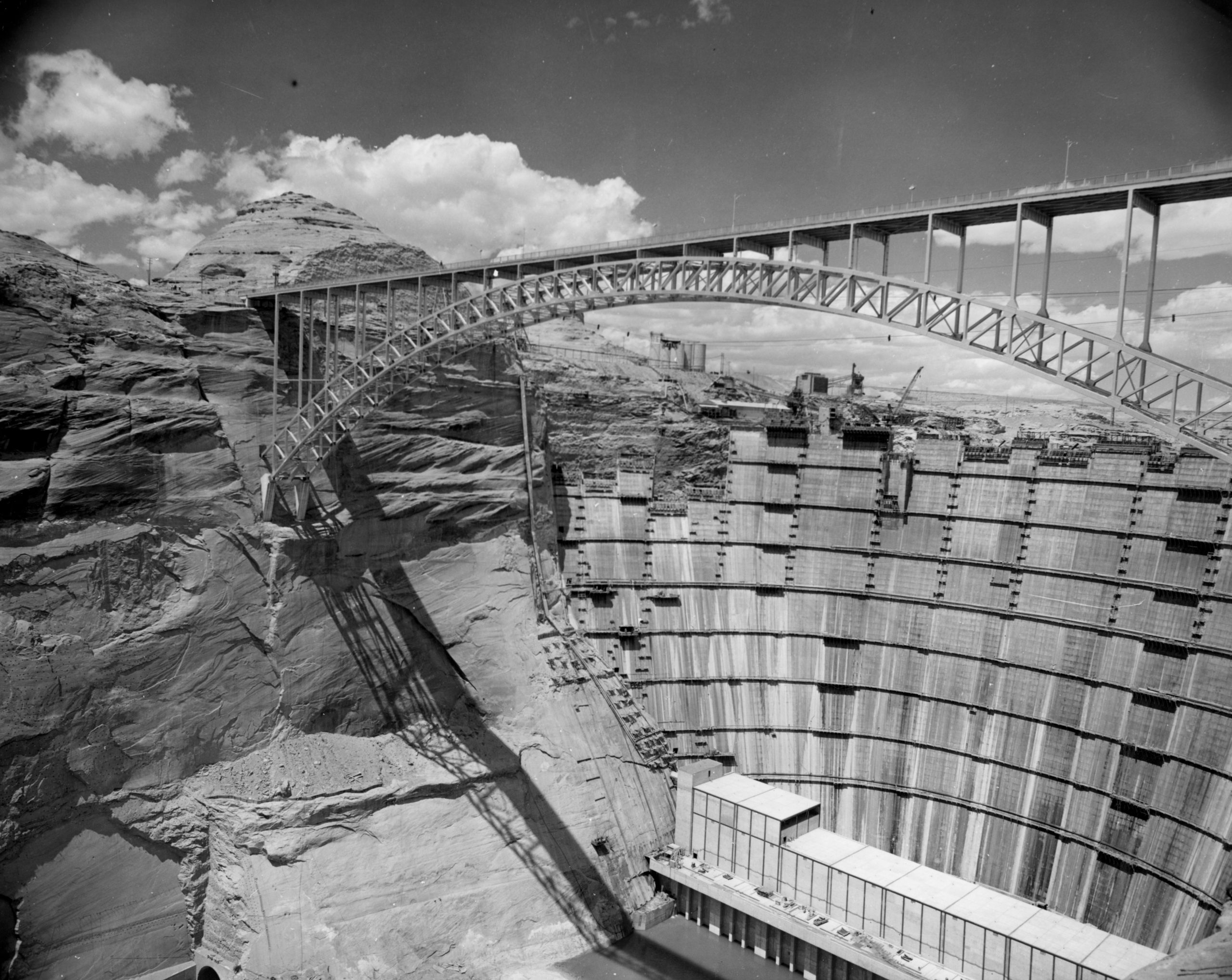
In the ensuing decades after the passage of the CRSPA, its ambitious goals began to take tangible shape on the western landscape. One of its faces became the dams associated with the Curecanti Project in Colorado. Another was the Navajo Dam constructed in northwestern New Mexico. Along the Utah and Wyoming border CRSPA took shape in the form of the Flaming Gorge Dam. And, perhaps most famously, CRSPA led directly to the controversial construction of the Glen Canyon Dam along the Utah and Arizona border.
CONTROVERSY IN ECHO PARK
The story of Glen Canyon Dam remains a contentious moment in U.S. environmental history, as it squarely pitted the interests of the Bureau of Reclamation and western developers against those of a burgeoning American environmental movement.
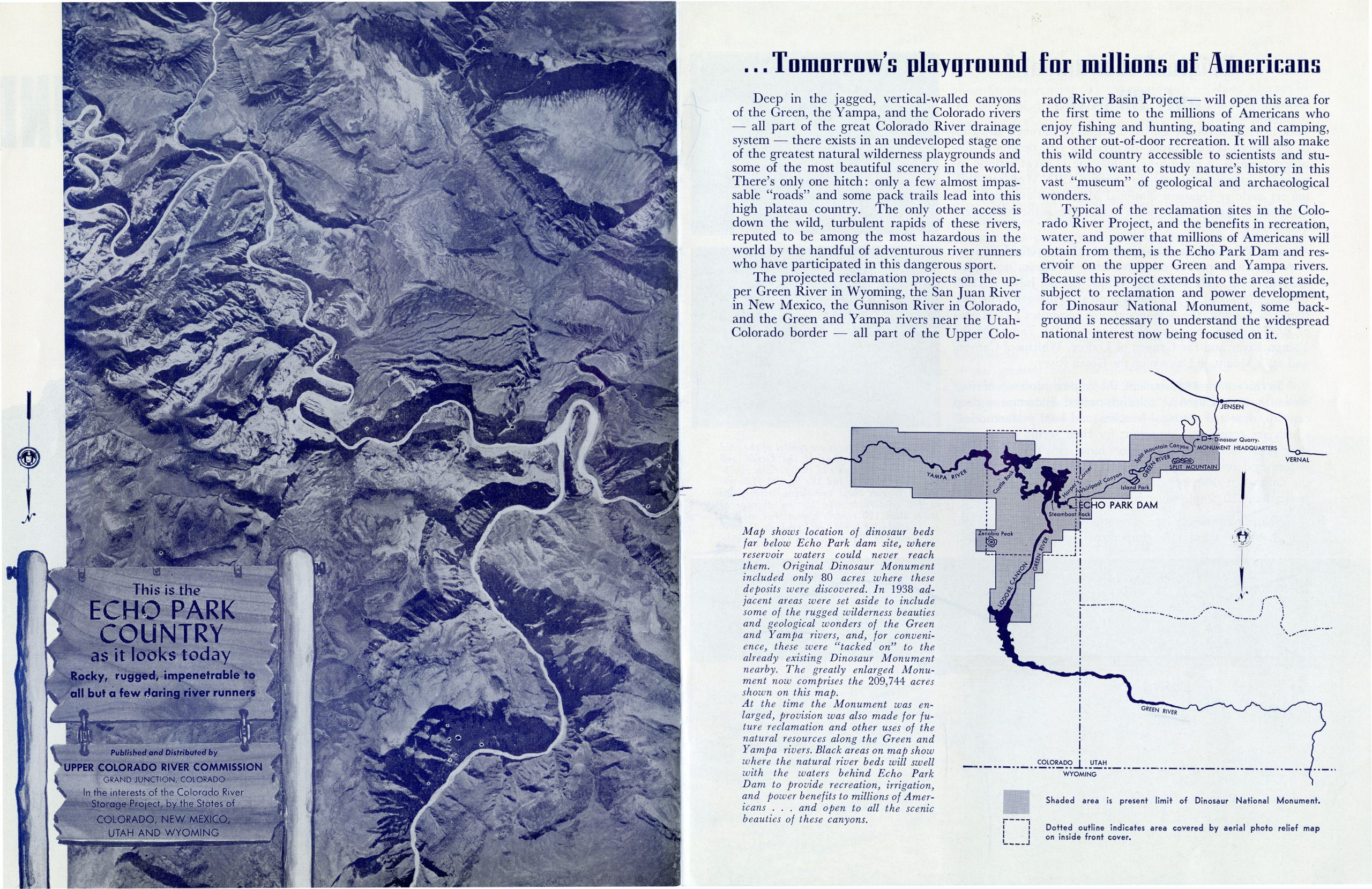
When planning first began on the Upper Basin developments that would culminate with dams at Flaming Gorge and Glen Canyon, planners first cast their eyes east towards Utah’s Uinta Basin. In the mid-1950’s planners and promoters pushed for the construction of two dam sites in Dinosaur National Monument, one at Echo Park (at the confluence of the Yampa and Green rivers), and one at Split Mountain.
An unexpected push against placing the dams in Dinosaur National Monument by an organized environmental movement ultimately led planners to abandon the effort, and the U.S. Congress to enact laws that better spelled out the types of development that could occur in National Park Service areas. The complex legal discussions pertaining to Echo Park and Glen Canyon can be traced through records created by Utah’s Attorney General, and held at the Utah State Archives. With the Echo Park development off the table, and a promise from the Sierra Club not to oppose a dam site at Glen Canyon, the Bureau of Reclamation moved forward with development along the border of Utah and Arizona.
With passage of CRSPA, and allocation of $760 million in federal funds for Flaming Gorge and Glen Canyon, construction on Glen Canyon Dam began in late 1956. Upon its completion in 1966 its impounded waters (named Lake Powell after General John Wesley Powell who had first navigated the whole of the Colorado River in 1869) could reach a full capacity of 26, 214,900 acre feet, making it the second largest development along the Colorado after Lake Mead. The construction of the Glen Canyon Dam has long served as a significant moment of loss for many who were able to witness Glen Canyon before it was flooded by the dam.
CRSPA was a crucial moment in both the river’s history, as well as Utah’s relationship to it. In addition to providing the mandate and funds to build the dam sites at Flaming Gorge and Glen Canyon, this legislation also authorized the creation of the Central Utah Project (CUP), a federal water project specifically tasked with overseeing Utah’s use and development of its allotted share from the river.
The story of federal efforts to establish and manage the Central Utah Water Project, which has proven to be among the most complex and costly provisions of CRSPA, will serve as the subject for the final blog post in this series.
SOURCES
Reisner, Marc. Cadillac Desert: The American West and Its Disappearing Water. New York: Penguin Books, 1993.
Worster, Donald. Rivers of Empire: Water, Aridity, and the Growth of the American West. New York: Oxford University Press, 1992.
- Bureau of Reclamation/
- Central Utah Project/
- Colorado River/
- Colorado River Compact of 1922/
- Colorado River Storage Project Act/
- CRSPA/
- CUP/
- Dinosaur National Monument/
- Echo Park/
- Glen Canyon/
- Glen Canyon Dam/
- Governor George D. Clyde/
- Governor Henry Blood/
- Split Mountain/
- State Engineer Ed Watson/
- Upper Basin Compact/
Recent Posts
From Pews to Pixels: Weber State’s Stewart Library Digitizes New Zion Baptist Church’s Legacy
New Finding Aids at the Archives: March 2024
Sealing the Deal: Tooele County Clerk’s Office Unlocks the Vault with Historic Marriage Records
Summer 2024 Internships
Developing History: Park City Museum’s Snapshot into the Past
Authors
Categories
- Digital Archives/
- Electronic Records/
- Finding Aids/
- General Retention Schedules/
- GRAMA/
- Guidelines/
- History/
- Legislative Updates/
- News and Events/
- Open Government/
- Records Access/
- Records Management/
- Records Officer Spotlights/
- Research/
- Research Guides/
- State Records Committee/
- Training/
- Uncategorized/
- Utah State Historical Records Advisory Board/
