News
Search Type
Website
Catalog
Name Indexes
Digital Collections
Agencies (all)
Agencies (current)
Series Keyword Search
Series Number Search
General Schedules
State Records Committee
Government Records Office
Search this site
Search Now
Descriptions of
all
records in our collection, with
series inventories
and without
Search Now
Name indexes search
Search Now
Digital collections search
Search Now
Agencies search
Search Now
Search agencies (HINT: omit common words such as city, office, department, services, etc.)
Search Now
General schedules search
Search Now
Series Keyword Search Phrase
Search Now
Series Number
Search Now
Appeal decision text
Search Now
GRO Appeal decision text
Search Now
September 9, 2025
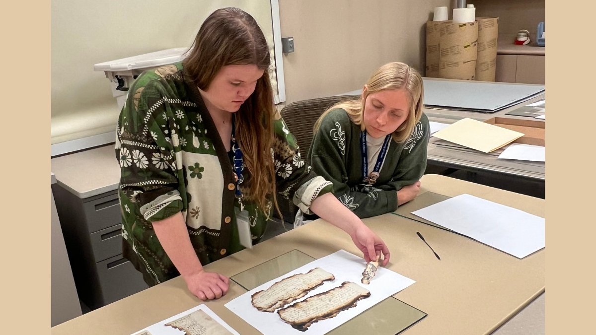
Finding Aids in the Archives: August 2025
Our archivists write inventories as finding aids to describe records. Here are the newest ones created during August: Davis County (Utah). County Surveyor Miscellaneous map collection Davis County (Utah). County Surveyor Road plans The following series inventories were updated during August 2025 by our archivists: Board of Education. Office of Education Utah Conference on Higher Education reports Board of Education.
December 20, 2021
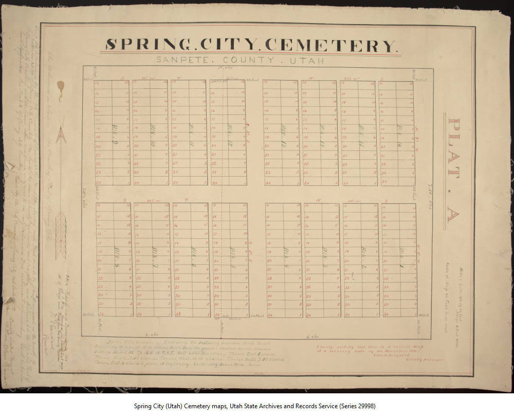
Sanpete County Records Now Online
A small digital collection that contained only the earliest Spring City Council minutes has now been expanded to include several maps from the same city. Records in this collection were created by various local government entities in Sanpete County and document the history of the county. Sanpete County, located in central Utah, is a largely agricultural county founded in 1850.
September 15, 2021
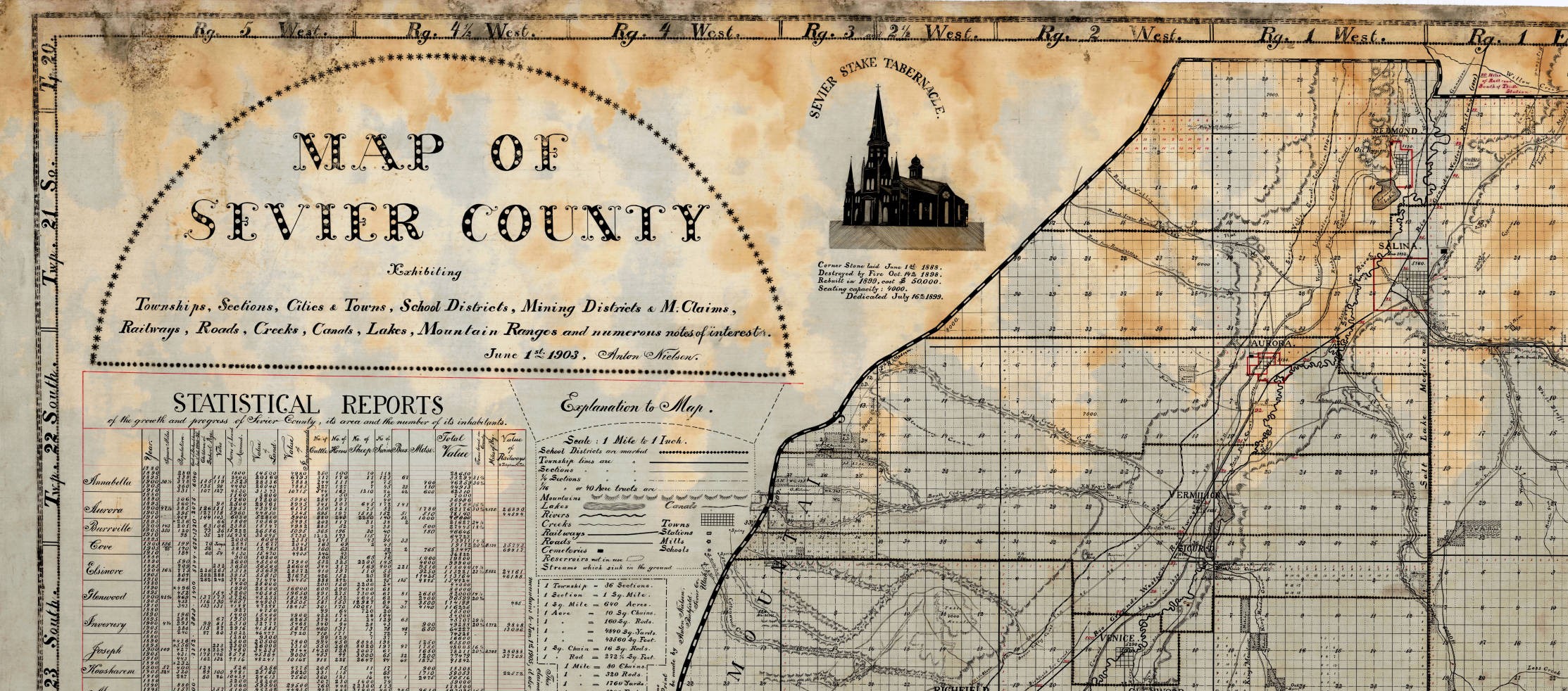
“More Than His Share of Genius and Skill”: The Maps of Anton Nielsen
The traditional function of a map is to convey information about geography in a two-dimensional way and on a scale that is comprehensible to the user. Maps document relationships of places and geographical features to one another and allow for calculation of distances. They can show lakes, roads, rivers, towns, and even invisible jurisdictional boundaries. But the richest maps are
July 14, 2021
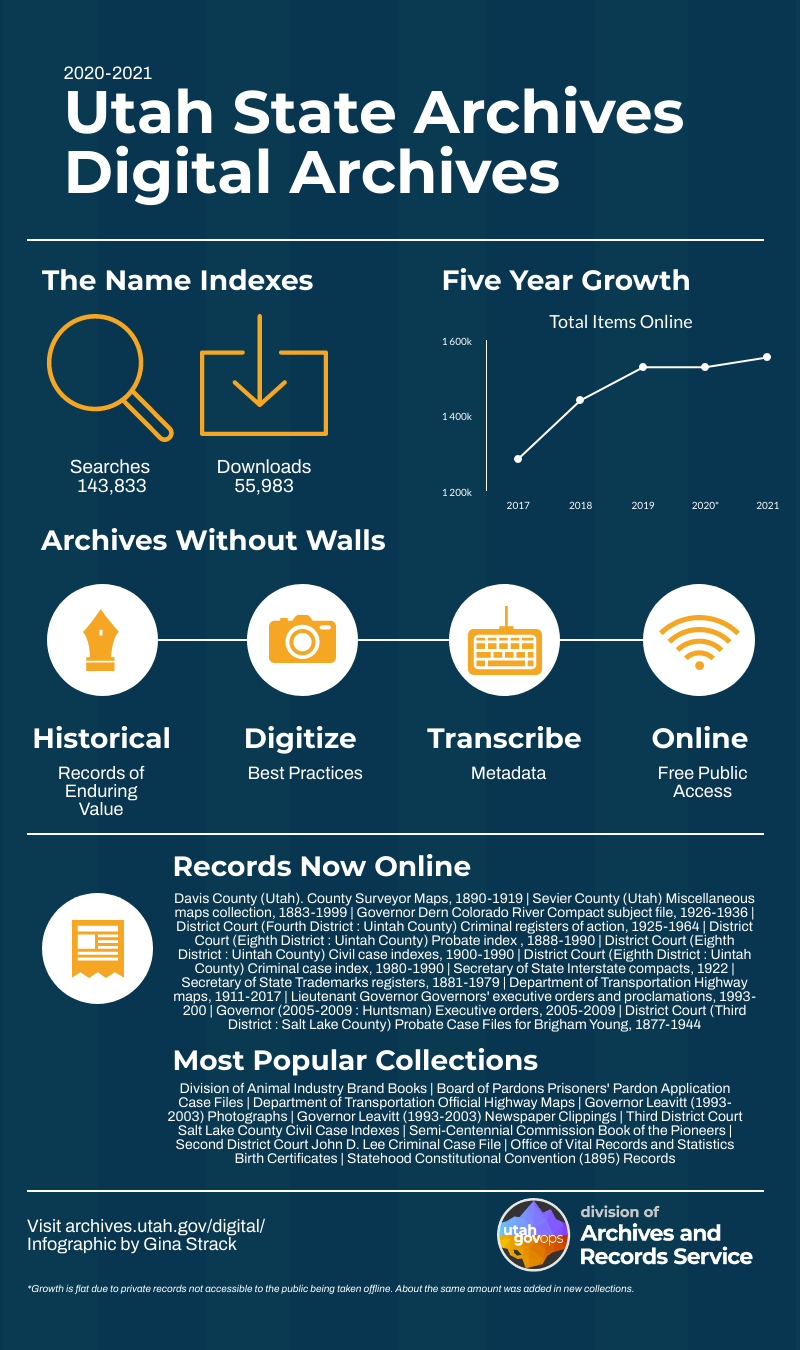
2020-2021 in the Utah State Digital Archives
An infographic visualizing the last year in the Digital Archives with information on number of items, statistics on use, and notable additions.
January 11, 2021
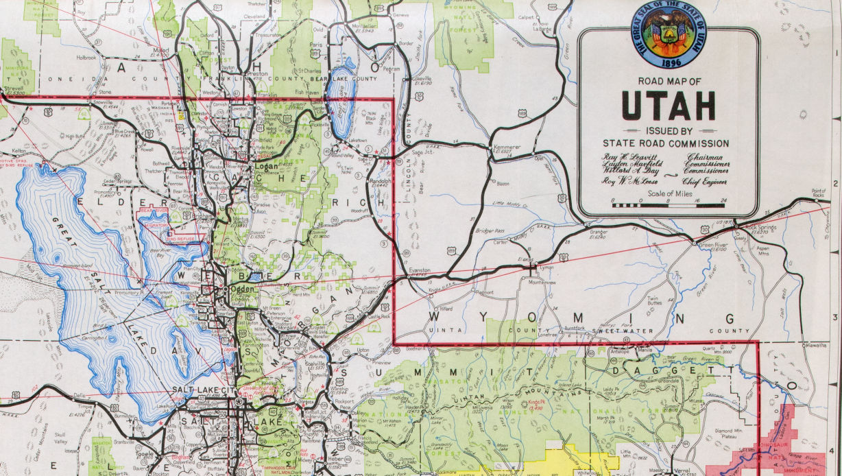
Highway Maps Online
Before we had GPS and phones with map apps, people used folded paper maps. Across the United States, transportation departments distributed free highway maps both as a public service and a way to promote tourism, including here in Utah. The Utah State Archives is pleased to announce that a collection of Official Highway Maps from the Utah Department of Transportation
December 9, 2015
Newly Processed: November 2015
All public records at the Utah State Archives are accessible through the Research Center. However, once processed the records are easier to use with proper storage and fuller descriptions, including online series inventories. The following list includes record series that were processed during the month of November 2015: Department of Transportation. Division of Right of Way Railroad maps, 1900-1960.
The Archives provides reference assistance over the
phone
, by
email
, and in-person by appointment.
Public Comment Policy
Recent Posts
Jul. 15, 2026
Fall 2026 Internships
Jul. 13, 2026
Internship Alumni Files: Taylor Burnette
Jul. 08, 2026
Finding Aids in the Archives: June 2026
Jun. 30, 2026
Meet the New USHRAB Members
Jun. 26, 2026
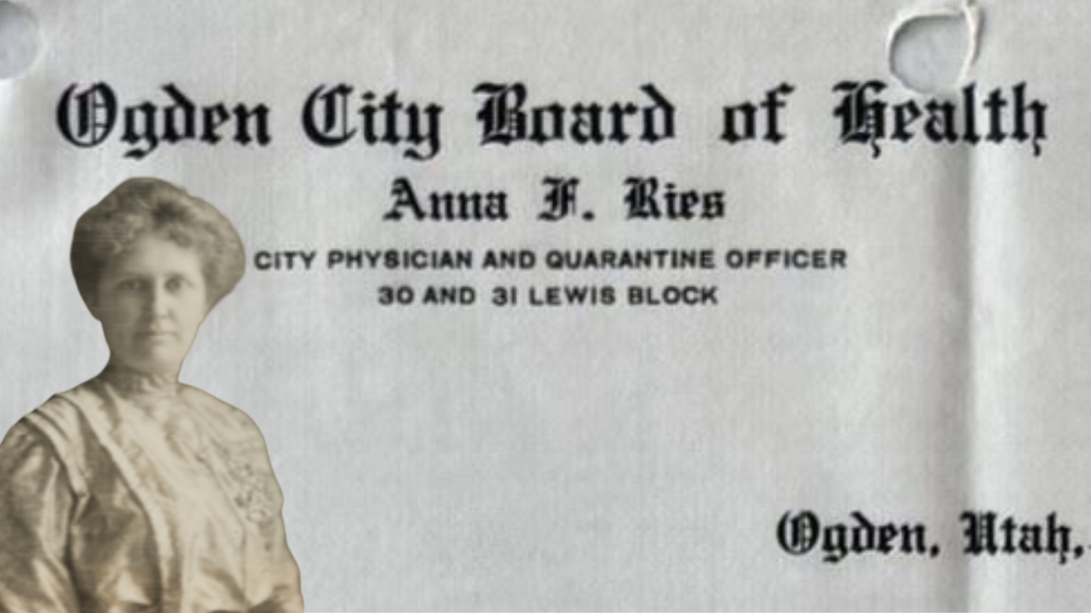
Ogden City’s First Female Physician: Dr. Anna Frances Ries Finley
Authors
Alan Barnett
21
Dylan Mace
3
Genesie Miller
21
Gina Strack
395
Guest Author
21
Heidi Steed
20
Heidi Stringham
16
Jim Kichas
44
Kendra Yates
24
Katie McGirt
1
Lisa Catano
4
Lauren Katz
104
Maren Peterson
31
Matt Pierce
4
Renee Wilson
36
Rebekkah Shaw
132
Categories
Certification
/
Digital Archives
/
Electronic Records
/
FAQ
/
Finding Aids
/
General Retention Schedules
/
GRAMA
/
GRAMA FAQs
/
Guidelines
/
History
/
Legislative Updates
/
News and Events
/
Open Government
/
Records Access
/
Records Management
/
Records Officer Hub
/
Records Officer Spotlights
/
Research
/
Research Guides
/
RIM FAQs
/
Roles and Responsibilities
/
State Records Committee
/
Training
/
Uncategorized
/
Utah State Historical Records Advisory Board
/